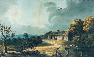
The Weil farm c 1830. A well-dressed woman sits talking to a farmwife in the foreground. The Weil farm is shown on Richardson's map of 1795 (although spelled as Weell), located to the north of the confluence of the Levern Water and the Brock Burn: probably near the ground on which Levernside Road was built later.
This watercolour is one of a series made by and unknown artist working for the Maxwell family. The paintings show different parts of the Pollok Estate, which was owned by the Maxwells, and are a unique record of an early 19th century country estate in the west of Scotland.
Reproduced with the permission of the National Trust for Scotland
Keywords:
Brock Burn, farmhouses, farms, landscapes, Levern Water, Pollok Estate, watercolours, Weil Farm, women
You have 0 images in your photo album.