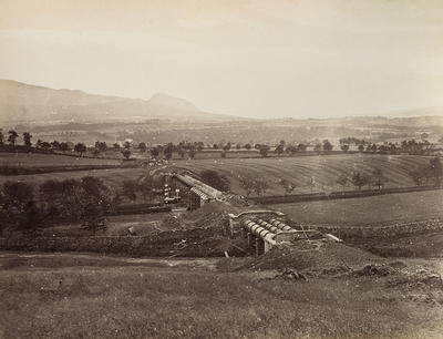
A Thomas Annan photograph, 1876, of the Loch Katrine aqueduct crossing the Endrick Valley on its way to Mugdock Reservoir near Milngavie. The distinctive "hump" of Dumgoyne is in the distance, centre.
As Glasgow's population and industries grew, the demand for fresh water continued to increase. A new pipeline was laid alongside the existing aqueduct in 1866 to carry an additional 10 million gallons to the city, increasing the capacity of Glasgow's water supply to 50 million gallons per day.
Reference: D-WA 22/1/16
Reproduced with the permission of Glasgow City Council, Libraries Information and Learning
Keywords:
aqueducts, Loch Katrine water scheme, pipelines, public water supply
You have 13 images in your photo album.